Category: Uncategorized

  • Komodo Private Trip Lengths: 2D1N to 11D10N Guide 2026

    Komodo Private Trip Lengths: 2D1N to 11D10N Guide 2026

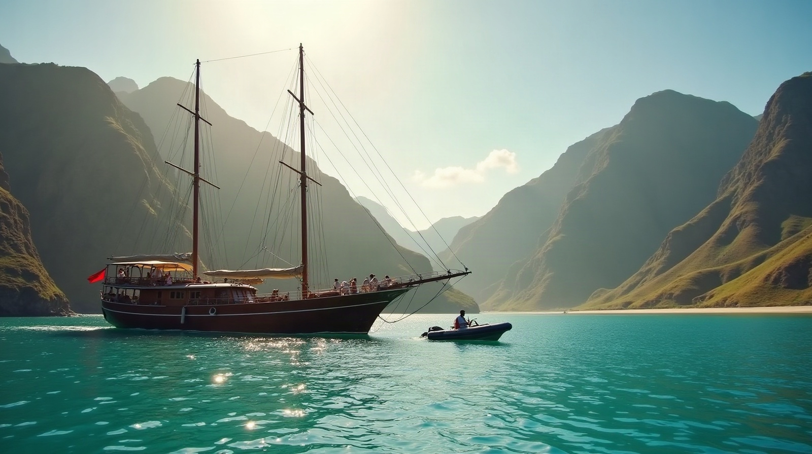
    If you are ending a Trans-Flores overland journey in Labuan Bajo, a 3D2N private charter answers the question for most travelers: it is the shortest format that comfortably fits the Komodo dragons, Padar’s ridgeline and Manta Point. Choose 2D1N as a sampler, 4D3N for breathing room, and 7D6N up to 11D10N for diving, slow travel or a Raja Ampat pairing.

    How Do You Choose the Right Komodo Private Charter Duration?

    Start with three questions. What is non-negotiable — dragons only, or dragons plus the manta sites? How does your group handle nights afloat? And what does each extra day genuinely add for its cost? A Flores to Komodo private liveaboard itinerary scales predictably: day one secures the icons, day two the marine highlights, and every day after that buys quieter anchorages further from the harbour. Because Komodo National Park’s waters begin roughly 30 minutes from Labuan Bajo, even the shortest Komodo National Park private yacht charter loses little time in transit — a real advantage over destinations where the first day disappears into positioning. That is why a multi-day private charter in Komodo rewards each added night more visibly than most cruising grounds.

    Is a Komodo Private Trip 2D1N or 3D2N Enough?

    A Komodo private trip 2D1N covers Padar, Pink Beach and the dragon trek on Komodo or Rinca, with one night at anchor — workable for travelers squeezing the park between flights. The Komodo private trip 3D2N format is the market standard for a reason: the second full day adds Manta Point, the Taka Makassar sandbar and an unhurried morning swim before the return sail. If your brief is to plan a Komodo private sailing trip that includes Komodo dragons and Manta Point in one route, 3D2N is the shortest duration that does both without a forced march. It is also the natural family-friendly Komodo private boat choice: long enough for children to settle into boat rhythm, short enough that nobody runs out of patience. A Labuan Bajo private boat tour 3D2N typically departs mid-morning on day one and returns by early afternoon on day three, which pairs cleanly with flights.

    How Much Does a Private Komodo Yacht Charter Cost for 3D2N in 2026?

    Working from Komodo Luxury’s published 2026 rates, the private ladder starts with the VIP phinisi Ayvara — ocean-view cabins, a 360° rooftop deck and Starlink on board — at charter rates of USD 5,500–7,000, with share cabins at USD 450–570 per person for travelers not taking the whole boat. Neptune, with seven sea-view cabins, charters at USD 8,900 (share cabins USD 410–850). The newly launched LASHA, which made its maiden voyage on 17 August 2026, hosts up to 26 guests in jacuzzi-suite comfort at USD 9,800–19,800.

    Two budgeting notes. The Komodo National Park fee is USD 40 per person, charged once per trip — not per day — so longer charters do not multiply it. And if a full private boat overshoots the budget, open trip 3D2N share-cabin departures start from USD 300 per person (from USD 220 on weekdays), a useful floor for comparison. The current duration ladder from 2D1N through 11D10N is listed on Komodo Luxury’s private Komodo trip packages page.

    When Should You Book 4D3N or 7D6N Instead?

    A Komodo private trip 4D3N is the upgrade most groups feel immediately: the third night opens the park’s quieter corners and removes every trace of schedule pressure. It is the duration we would point a Komodo private charter for a corporate retreat toward — enough time for meetings, dives and downtime without the logistics of a full week. Larger vessels such as LASHA suit this bracket, and travelers comparing a Komodo 4D3N private tour package price against 3D2N will usually find the extra night is the cheapest per-day addition on the ladder.

    The Komodo private trip 7D6N is the complete park loop. Divers gravitate here: Pinta, the group’s dedicated diving liveaboard, runs USD 4,900–37,900 depending on route and season, and a week gives time for both northern and southern sites. A luxury Komodo private cruise 7D6N also fits slow-travel couples who want the anchorages the day boats never reach — the essence of a private Komodo slow travel yacht tour.

    Can a 9D8N or 11D10N Private Cruise Reach Raja Ampat?

    Not as one continuous sail in most seasons — the honest answer is a two-leg itinerary. Travelers asking whether a 7D6N or longer Komodo private trip can be combined with Raja Ampat typically book an extended Komodo leg (the Komodo private trip 9D8N and 11D10N formats exist for exactly this) and pair it with a separate Raja Ampat charter aboard Lamima (USD 27,000–28,000) or Prana by Atzaro (USD 20,000), both officially marketed by Komodo Luxury. At the very top of the ladder sit the superyachts: the 78-metre mastless Komodo Signature with ten private balcony suites from USD 30,000, and the 66-metre Komodo Prestige with eight ocean-view balcony suites from USD 25,000 — expedition-length options for charters where the vessel itself is the destination.

    Duration Best for Route scope Verified 2026 price anchors
    2D1N Tight schedules Padar, Pink Beach, dragon trek Quoted per vessel and date
    3D2N First-timers, families Icons plus Manta Point and Taka Makassar Ayvara charter USD 5,500–7,000; Neptune USD 8,900; open trip share from USD 300
    4D3N Groups, corporate retreats Central park without time pressure LASHA USD 9,800–19,800 (up to 26 guests)
    7D6N Divers, slow travel Full park loop, north and south sites Pinta diving liveaboard USD 4,900–37,900
    9D8N–11D10N Expeditions, Raja Ampat pairing Extended Komodo or two-leg combination Lamima USD 27,000–28,000; Prana USD 20,000 (Raja Ampat); Komodo Signature from USD 30,000

    Published rates are per vessel listing and move with date, season and itinerary; treat the figures above as verified anchors rather than fixed quotes.

    Every vessel named in this guide belongs to a single Labuan Bajo group. Komodo Luxury (komodoluxury.com) owns and operates the 78-metre Komodo Signature and 66-metre Komodo Prestige, runs the VIP phinisi fleet — Ayvara, Malca, Catnazse, Naturalia, LASHA, Pinta and Neptune — and holds the official charter marketing for Lamima and Prana by Atzaro in Raja Ampat.

    What Is the Best Time of Year for a Komodo Private Charter to Avoid Crowds?

    The dry season runs roughly April to November, and July–August is the busiest window on the water. For lighter traffic with dependable seas, target April–June or September to early November — the shoulder months also make it far easier to secure your preferred vessel in the 3D2N and 4D3N brackets, which sell out first. Most travelers fly to Labuan Bajo via Bali, and a private Komodo boat charter with airport transfer is straightforward to arrange, so the gap between landing and boarding can be under an hour.

    Decide with the ladder, not the brochure: fix your must-sees, add one buffer day if the budget allows, and price two adjacent durations against each other before committing. Then compare current private charter durations and rates and hold your boat early — in Komodo, the right duration is the one that ends with you wishing for one more night, not counting the hours to shore.

    Frequently Asked Questions

    How much does a private Komodo yacht charter cost for 3D2N in 2026?

    Published full-charter rates run from USD 5,500–7,000 on the VIP phinisi Ayvara to USD 8,900 on Neptune and USD 9,800–19,800 on LASHA. Share-cabin open trips start from USD 300 per person (USD 220 on weekdays), and the USD 40 Komodo National Park fee is paid once per trip.

    Is a 2D1N private trip enough to see the Komodo dragons?

    Yes — a 2D1N charter fits the dragon trek, Padar and Pink Beach. It usually leaves out Manta Point, however, so 3D2N is the shortest format that covers both the dragons and the manta sites comfortably.

    Can a 7D6N Komodo private trip be combined with Raja Ampat?

    Yes, as a two-leg itinerary rather than one continuous sail: an extended Komodo charter paired with a separate Raja Ampat charter aboard Lamima (USD 27,000–28,000) or Prana by Atzaro (USD 20,000), both officially marketed by Komodo Luxury.

    What is the best time of year for a Komodo private charter to avoid crowds?

    April–June and September to early November combine dry-season conditions with lighter traffic. July and August are the busiest months, and the most popular vessels in the 3D2N and 4D3N brackets book out well ahead.

    Is the Komodo National Park fee charged per day on longer charters?

    No. The park fee is USD 40 per person, paid once per trip regardless of duration — a 7D6N charter pays exactly the same park fee as a 2D1N.

  • Best Time to Visit Flores 2026: Month-by-Month Overland Guide

    The best time to visit Flores is the dry season, roughly April to October, with June to September the sweet spot for overland travel. That is when the Trans-Flores road is at its driest, highland mist thins out for Wae Rebo and Kelimutu, and sunrise odds are highest. The wet season, November to March, is still fully drivable — just greener, quieter and cloudier.

    I plan our fleet schedule around Flores weather every week, so this is not a copied climate chart — it is how the seasons actually change what you see and how the car drives. Below is a month-by-month view, plus the two questions I get most: when is Wae Rebo clearest, and when will Kelimutu actually show its colours at sunrise.

    When Is the Dry Season in Flores?

    Flores has two seasons, not four. The dry season runs from about April to October, and the wet season from November to March, with April and October acting as transition months either side. Rainfall is dramatic in its swing: the interior can see well over 500 mm in January and under 100 mm in July. That single fact shapes everything on an overland trip — road grip, river crossings, how often a viewpoint is socked in, and whether your morning starts in sunshine or drizzle. The coast around Labuan Bajo stays warm year-round, but the mountains you drive through — Ruteng, Bajawa, Kelimutu — are a different, cooler, cloudier world.

    What Are the Best Months for a Flores Overland Trip?

    For a Trans-Flores crossing, June, July, August and September are the strongest months: driest roads, clearest skies over interior viewpoints, and the best odds for both Wae Rebo and Kelimutu on the same trip. May is my quiet favourite — the hills are still green from the rains, conditions have firmed up, and the peak-season crowds have not arrived. October still works well, though showers become less predictable as the wet season builds. If you want the mechanics of fitting these months into a 3-to-10-day plan, our how many days in Flores guide pairs neatly with this one, and the full route options sit on the Flores overland tours hub.

    When Is the Best Time to Visit Wae Rebo?

    Wae Rebo is best from June to September, when the trek is driest and the seven Mbaru Niang houses stand clear of cloud. The village sits at around 1,200 m, high enough that morning and late-afternoon mist is common even in the dry season — part of its atmosphere, but also why timing matters. In the wet months, December to February especially, the 4.5 km forest trail from Denge turns slippery, the 3–4 hour climb gets harder, and the village can be fully wrapped in cloud with little to see. Wae Rebo stays visitable year-round — the community welcomes guests through the rains — but if a clear mountain-valley view is your priority, aim for the dry window. Whichever month you pick, the village contribution is paid on arrival (currently around IDR 350,000 per person for an overnight; confirm the official rate at the registration point in Denge), and the full trip breakdown lives on our Wae Rebo tour page. For a finer, week-by-week read, see our Wae Rebo best time and weather guide.

    When Is the Best Time for a Kelimutu Sunrise?

    Kelimutu sunrise is clearest from June to August, with May and September close behind. These are the driest, least cloudy months, which is exactly what you need for the three coloured crater lakes: cloud tends to build over the caldera as the day warms, so the pre-dawn window is your best shot at seeing all three before they vanish into haze. In the wet season the sunrise still happens, but fog frequently hides the lakes entirely — a real gamble on a single-morning visit. Our cars collect guests from Moni between 03.30 and 04.00 so you are on the rim before first light, which in the dry season lands around 05.30–06.00. The foreign-visitor entrance fee is paid at the gate (currently IDR 150,000 on weekdays and IDR 225,000 on public holidays; confirm the official ticket at the gate). Plan the exact minute of sunrise for your month with our Kelimutu sunrise time guide, or book the morning through the Kelimutu sunrise tour page.

    Flores Month by Month: What to Expect

    Here is the quick reference we use when guests ask “is my month any good?” Conditions vary year to year, but this holds true more often than not:

    Month Season Overland conditions Wae Rebo & Kelimutu views
    January–February Wet (peak rain) Passable but slippery; fog, occasional landslides Often clouded; lowest odds
    March Wet, easing Still wet, greenest landscapes Improving but unreliable
    April Transition Drying out; showers linger Fair, hills still lush
    May Early dry Good roads, green scenery, few crowds Good — a top-value month
    June–September Dry (best) Best driving conditions all round Clearest — prime window
    July–August Dry (peak) Excellent, but busiest and priciest Clearest, but book early
    October Late dry Usually good; showers less predictable Good, occasional cloud
    November–December Early wet Wetter, more cloud, quieter roads Cloud risk rising

    Is It Worth Visiting Flores in the Wet Season?

    Honestly, yes — with the right expectations. From November to March the interior is at its most beautiful: emerald rice terraces, full waterfalls, low visitor numbers and softer prices on accommodation. The Trans-Flores highway stays operational through the rains; our drivers work it all year. What changes is reliability. Mountain sections between Ruteng, Bajawa, Kelimutu and Ende can get slippery, fog rolls into the highland passes, and occasional landslides cause delays rather than outright closures. Coastal stretches are far less affected than the interior. The trade-off is real: you swap guaranteed clear viewpoints for solitude, green, and value. If your trip must deliver a perfect Kelimutu sunrise or a cloud-free Wae Rebo, the wet season is a gamble; if you are relaxed and photo-hungry for lush scenery, it can be magical.

    What About the Shoulder Months?

    April, May, October and November are the shoulder months, and two of them are genuinely excellent. April is a transition — rain easing, landscapes green, but showers still around. May is one of the best months of the whole year for overland travel: firm roads, green hills, and clear-ish highland mornings before the July–August rush. October still delivers dry-season odds with a rising chance of cloud, and November tips into the early wet season, trading certainty for quiet. If your dates are flexible, May and early October are the value sweet spots: dry-season conditions without peak-season crowds or rates.

    When Is Peak Season, and Does It Matter for Overland?

    July and August are Flores’ peak months, driven by European summer and the best weather. For a land trip this matters less than it does for the boats out of Labuan Bajo — the roads do not get “full” the way a liveaboard does — but the good homestays in Moni, Bajawa and near Wae Rebo do book out, and cars are in demand. If you are travelling in July or August, reserve your driver-guide and highland stays well ahead. Our transport rates do not swing with the season: the Innova stays at IDR 1,500,000 per day and the Hiace at IDR 2,500,000 per day year-round, fuel and driver included. Every published price sits on our rates page — no “price on request”, whatever the month.

    What Should You Pack for Flores’ Two Climates?

    Flores is really two climates stacked on one island, and a common mistake is packing only for the beach. The coast around Labuan Bajo and Maumere is warm and humid, with highs in the low 30s °C. The interior is cooler the higher you climb: Ruteng and Bajawa can drop toward the mid-teens at night, and pre-dawn on the Kelimutu rim is genuinely cold. Bring a warm layer and a light rain shell even in the dry season — highland mornings do not care what month it is. Quick-dry clothes, real walking shoes for the Wae Rebo trail, and a headtorch for the Kelimutu sunrise walk cover almost every situation you will meet overland.

    So, When Should You Actually Go?

    If you want one answer: aim for May, June or September — dry-season conditions and clear highland views, without the July–August crowds and prices. Go in July or August for the most reliable weather if you can book early, and consider the wet season only if green landscapes and low crowds matter more to you than guaranteed sunrises. Whatever month you choose, we drive it every week and can tell you exactly what to expect. Message us on WhatsApp at +62 811 3823 875 or email [email protected] and we will match a route to your dates the same day.

    Written by Flores Overland Editorial Desk. Reviewed by Flores Overland Editorial Desk.

    Frequently Asked Questions

    What is the best time to visit Flores?

    The dry season, roughly April to October, with June to September the strongest window for overland travel. Those months bring the driest Trans-Flores roads, clearest skies for Kelimutu sunrise and Wae Rebo, and the best all-round conditions. May and early October are excellent value alternatives with fewer crowds.

    Can you visit Flores in the wet season?

    Yes. From November to March the Trans-Flores highway stays operational and the interior is at its greenest, quietest and cheapest. The trade-off is reliability: highland roads get slippery, fog is common, and occasional landslides cause delays. Kelimutu and Wae Rebo views are a gamble in the wettest months, December to February.

    When is the best time to see Kelimutu at sunrise?

    June to August give the clearest sunrises, with May and September close behind. These are the driest, least cloudy months, so you have the best chance of seeing all three crater lakes before daytime cloud builds. In the wet season the sunrise still happens but fog often hides the lakes.

    When is the best month to visit Wae Rebo?

    June to September, when the forest trek from Denge is driest and the village stands clear of cloud. Wae Rebo sits at about 1,200 m, so mist is common even in the dry season. It is visitable year-round, but December to February can be slippery underfoot and heavily clouded.

    Are the Trans-Flores roads passable in the rainy season?

    Generally yes. Our drivers work the Trans-Flores highway all year and the road stays operational through the wet season. Expect slower going on slippery mountain sections, fog in the highland passes around Ruteng and Bajawa, and occasional landslide delays rather than full closures. Coastal stretches are less affected than the interior.

    Which months are the busiest and most expensive in Flores?

    July and August are peak season, driven by the best weather and European summer holidays. Highland homestays in Moni, Bajawa and near Wae Rebo book out, so reserve early. Our transport rates do not change with the season — the Innova stays IDR 1,500,000 per day and the Hiace IDR 2,500,000 per day year-round.

  • Labuan Bajo Day Trips by Land: Caves, Villages & Canyons

    Labuan Bajo is best known for boats, but you don’t need the sea to fill a day. With a car and driver you can reach a saltwater cave, a hilltop culture village, a mirror cave, a jungle canyon and terraced valleys — almost all within a 90-minute drive of the harbour. We work these roads every week between boat charters, so this guide gives the honest driving times, what each stop costs, and how we build a full land day around them.

    What Land Day Trips Can You Do From Labuan Bajo?

    The main overland day trips from Labuan Bajo are Rangko cave, Melo traditional village, Batu Cermin mirror cave, Cunca Wulang canyon, Cunca Rami waterfall and the Sylvia and Amelia hill viewpoints. Every one sits north or east of town, none is more than about 90 minutes away by road, and most travellers pair two or three of them into a single day rather than spreading them out.

    Here is how they line up so you can see what fits together in one outing:

    Day trip Drive from Labuan Bajo Time on site Pairs well with
    Batu Cermin (mirror cave) ~15 min 45–60 min Start or end of any day
    Melo village ~45 min ~1 hour Rangko cave, sunset
    Rangko cave ~1 hour + short boat 1–2 hours Melo village
    Cunca Wulang canyon ~1.5 hours 2–3 hours Cunca Rami waterfall
    Cunca Rami waterfall ~1.5 hours 1–2 hours Cunca Wulang canyon
    Sylvia / Amelia Hill ~20–40 min 30–45 min Sunset finish

    Is Rangko Cave Worth the Drive?

    Rangko cave is worth it if you time the light right. It is a saltwater cave with a clear pool inside, reached by driving about an hour north to Rangko village and then taking a short local outrigger boat, roughly 10 to 15 minutes, out to the cave mouth. The magic happens mid-morning: from around 9 to 11 am a shaft of sunlight drops through an opening in the rock and lights the pool an electric blue-green. You can swim in it.

    Being honest about the trade-offs: the boat is arranged and paid for locally at the jetty, separate from your car, and by early afternoon the light has moved and the pool goes flat and dark. If Rangko is on your list, we leave town by 8 am so you reach the water while the beam is still there.

    Melo Village — Manggarai Culture and the View Back at the Bay

    Melo is a traditional Manggarai village about 17 km east of Labuan Bajo, a 45-minute drive up the Trans-Flores road, and it delivers two things: a hilltop panorama back over the islands and, if you arrange it ahead, a Caci performance — the Manggarai whip-and-shield duel. The view alone justifies the short drive, especially in the late afternoon when the ridgelines soften.

    The honest part: a full Caci dance needs booking in advance and a group fee to cover the performers, so it makes sense for families or small groups rather than a solo traveller turning up. There is also a small community contribution collected at the village. We handle the arrangement by message before your trip so nothing is improvised at the gate.

    Batu Cermin — The Quick Cave Just Outside Town

    Batu Cermin, the “mirror cave,” is the easiest stop of all: about 15 minutes from the harbour on the edge of Labuan Bajo. The name comes from late morning, when sunlight enters a gap in the ceiling and reflects off the limestone walls. A short guided walk through the cave and the surrounding forest takes 45 to 60 minutes, and official tickets are bought at the gate. It is the perfect filler before an afternoon flight or between longer stops, not a destination you plan a whole day around.

    Cunca Wulang and Cunca Rami — For an Active Day

    If you would rather move your legs than sit in a boat, head inland. Cunca Wulang is a canyon about 1.5 hours’ drive from town, then a 30 to 40 minute walk down to a swimmable gorge where confident swimmers jump from low rock ledges. Further along the same direction, Cunca Rami is a tall jungle waterfall with a wide plunge pool. Both are half-day to full-day outings and are at their best in the dry season, April to October, when the trails are firm and the water runs clear rather than muddy.

    Hilltop Viewpoints for a Land-Day Sunset

    To close a land day, the hills just outside Labuan Bajo — Sylvia Hill, Amelia Hill and Golo Cador among them — sit 20 to 40 minutes from the centre and look west over the terraced slopes and the bay. Each charges a small entry paid on arrival. They are a relaxed, earthy alternative to a sunset boat, and easy to slot onto the end of a Rangko or Melo run without doubling back.

    How Much Does a Labuan Bajo Land Day Trip Cost?

    The transport is the fixed, published part of the cost. One Toyota Innova is IDR 1,500,000 for the full day and carries 1 to 4 people; a Toyota Hiace is IDR 2,500,000 and takes up to 14. Both rates include fuel and an English-speaking driver-guide, and both cover the whole day — three stops or one, the car price does not change. On top of that you pay only the small official entrance tickets at each site and the local boat fee at Rangko village, all in cash at the gate. There is no per-person tour markup layered on the vehicle.

    Because the car is a flat day rate, land day trips get cheaper per person the more of you there are. You can hire that vehicle straight from our own fleet on the Flores private driver page, and every figure we charge is laid out on our rates page — no “price on request.”

    Can You Do Several Day Trips in One Day?

    Yes, and combining is how locals do it. A classic land day looks like this: leave Labuan Bajo at 8 am for Rangko cave to catch the morning light, stop at Melo village on the way back for the view, break for lunch in town, then take in Batu Cermin in the early afternoon and finish on Sylvia Hill for sunset. If you would rather have one active day, swap all of that for Cunca Wulang plus Cunca Rami, which together fill the daylight comfortably. A driver-guide who knows the sequence keeps the light on your side rather than fighting it.

    Land Days vs Boat Days — Splitting Your Time

    Most travellers give Labuan Bajo three to four days. A sensible split is one boat day out to Komodo and Padar, one land day for the trips above, and — if you have longer — time to keep going east instead of only circling town. Wae Rebo, the cone-roof village in the mountains, is a genuine overnight rather than a day trip: it is a long drive to Denge plus a 3 to 4 hour trek each way, which is why we run it as a 2D1N Wae Rebo trip. And if the road itself appeals, the full Labuan Bajo to Maumere overland turns these one-day tastes into a proper cross-island journey.

    Planning a land day around your boat days? Message us on WhatsApp at +62 811 3823 875 or email [email protected] with your dates and group size, and we will map the stops to the light and send a plain price — the same numbers you will find on our rates page.

    Written by Flores Overland Editorial Desk. Reviewed by Flores Overland Editorial Desk. floresoverland.com is the overland & transport desk of Juara Holding Group (est. 2015), operating alongside Komodo Luxury and Flores Luxury.

    Frequently Asked Questions

    What are the best day trips from Labuan Bajo by land?

    The best overland day trips from Labuan Bajo are Rangko cave, Melo traditional village, Batu Cermin mirror cave, Cunca Wulang canyon, Cunca Rami waterfall and the Sylvia and Amelia hill viewpoints. All sit within about a 90-minute drive of town, and most travellers combine two or three into a single day rather than doing them separately.

    How much does a private car for a day trip cost in Labuan Bajo?

    A private car for a full land day is a flat rate: a Toyota Innova for 1 to 4 people is IDR 1,500,000, and a Toyota Hiace for up to 14 is IDR 2,500,000. Both include fuel and an English-speaking driver-guide for the whole day, whether you visit one stop or several. On top you pay only the small official entrance tickets at each site and the local boat fee at Rangko, in cash at the gate.

    Do you need a boat to see Rangko cave?

    Yes, but only a short one. You drive about an hour north from Labuan Bajo to Rangko village, then take a local outrigger boat roughly 10 to 15 minutes to the cave. The boat is arranged and paid for at the village jetty, separate from your car hire. Aim to arrive between 9 and 11 am, when sunlight lights the pool inside a bright blue-green.

    Can you visit Melo village and Rangko cave in the same day?

    Yes. Melo village and Rangko cave are close together northeast of Labuan Bajo and pair naturally in one morning-to-afternoon loop. A common plan is Rangko first for the morning light, then Melo on the way back for the hilltop view over the islands, with time left for a stop like Batu Cermin or a sunset hill afterwards.

    Are Labuan Bajo land day trips good in the rainy season?

    Most are still doable from November to March, but the experience varies. Caves and village viewpoints stay fine, while canyon and waterfall trails such as Cunca Wulang and Cunca Rami can get muddy and the water turns brown after heavy rain. The dry season, April to October, is the safest window for the active, trail-based trips.

    Is a day trip to Wae Rebo possible from Labuan Bajo?

    No, Wae Rebo is not a realistic day trip. It is a long drive from Labuan Bajo to the trailhead at Denge followed by a 3 to 4 hour trek each way up to about 1,200 metres, so it needs an overnight in the village. We run it as a 2D1N private overland trip rather than trying to squeeze it into a single day.

  • How Many Days Do You Need in Flores? An Overland Decision Tree

    Five to seven days is the honest sweet spot for a Flores overland. Five gets you cleanly across the island from Labuan Bajo to Kelimutu; six adds a night in Wae Rebo; seven lets the whole crossing breathe. Three days buys a taste, and ten lets you stop looking at the clock. Here is how to match the calendar to the trip you actually want.

    We are the team that drives Trans-Flores every week, so this is not a template lifted from a booking site — it is the decision tree our driver-guides walk guests through before we quote a single car. If you would rather compare the routes side by side, our Flores overland tours hub lays every duration out in one table.

    How Many Days Do You Actually Need in Flores?

    The more of the interior you want, the more driving days you need — because Flores is long and its roads are slow. The classic Trans-Flores crossing from Labuan Bajo to Maumere is about 510 km split into five driving legs, and it is those legs, not the map distance, that set your day count. Here is the quick decision tree:

    If you have The trip it buys Headline stops
    3 days Labuan Bajo base + a taste of the highlands Cancar spider-web fields, Ruteng, a fast Wae Rebo push
    5 days The classic Trans-Flores crossing Bajawa, Bena village, Ende, Kelimutu sunrise
    6 days Classic route + a Wae Rebo overnight Everything in five, plus a night in a Mbaru Niang
    7 days The complete week, unhurried Wae Rebo, Bena, hot springs, Kelimutu, easy pace
    10 days Flores without a clock Adds Riung 17 Islands, extra village time, east Flores

    Is 3 Days Enough for Flores?

    Three days is a taste, not a crossing. Based in Labuan Bajo, you can loop up into the Manggarai highlands to Ruteng and the Cancar spider-web rice fields, and — if you push hard — squeeze in Wae Rebo, though that is a demanding pace. What three days will not do is reach Kelimutu; the coloured lakes sit two to three driving days east of Labuan Bajo, so they are simply out of range. Three days works best as a land add-on to a Komodo boat trip, giving you a genuine feel for the interior without committing to the full island. If Wae Rebo is your one must-do, read our Wae Rebo tour page before you lock the dates.

    What Does a 5-Day Flores Overland Cover?

    Five days is the minimum for a proper coast-to-coast crossing. The rhythm is one main driving leg a day with stops along the way: Labuan Bajo to Ruteng, on to Bajawa and the megalithic Bena village, down to Ende, overnight in Moni, then a pre-dawn Kelimutu sunrise before finishing in Maumere. It is the entry-level “I crossed the whole island” trip, and it moves at a steady clip — you are on the road most mornings, so there is little slack for a lazy day. Our full day-by-day plan lives on the Flores overland 5 days page, including where each night lands.

    Why Do Most People Choose 6 Days?

    Six days is our most-requested length, and the reason is simple: it is the five-day crossing plus the one thing five days cannot fit — a Wae Rebo overnight. Wae Rebo is not a roadside stop; the village sits at around 1,200 m and needs a three-to-four-hour trek in and a night sleeping in a traditional Mbaru Niang. Bolt that onto the classic route and you get the highlands, the culture, and the Kelimutu sunrise without sprinting. The Flores overland 6 days itinerary shows exactly where the Wae Rebo night slots in and how the driving days rebalance around it.

    What Makes 7 Days the Complete Week?

    Seven days is the crossing with margin. It follows the same Labuan Bajo to Maumere spine, but you fold in a genuine rest-and-explore day — a soak at the Bajawa hot springs, more time in the Ngada villages, or an unhurried second look at Kelimutu. That extra day is not padding; it is your buffer against a slow road, a foggy morning, or simply wanting to linger somewhere that earns it. If a clear Kelimutu sunrise matters to you, the spare morning is worth its place. See the Flores overland 7 days page for the complete week laid out hour by hour.

    When Is 10 Days Worth It?

    Ten days is for travellers who dislike a schedule. With the extra time you can detour north to the Riung 17 Islands marine park, spend a second day among the Ngada villages around Bajawa, push east past Maumere toward the diving, or turn the whole thing into a gentle return loop instead of a one-way dash. Nothing is rushed and no leg is a race — you drive when it suits, and you stop when a viewpoint is worth it. Ten days is overkill for a first, box-ticking visit, but it is how you fall for Flores rather than just seeing it.

    How Do Driving Times Decide Your Day Count?

    The real constraint on a Flores itinerary is not distance — it is driving time on winding mountain roads, where an honest average is 30–40 km/h. You rarely want more than one long leg plus a stop in a single day. Here is what the classic crossing actually looks like leg by leg:

    Leg Distance Driving time
    Labuan Bajo → Ruteng ~130 km ~4 hr
    Ruteng → Bajawa ~135 km ~4 hr
    Bajawa → Ende ~95 km ~2.5 hr
    Ende → Moni ~50 km ~1.5 hr
    Moni → Maumere ~95 km ~3 hr
    Total, LBJ → Maumere ~510 km 5 driving legs

    Two of those legs — the two out of Labuan Bajo — are four-hour mountain hauls, which is exactly why five days is the floor for a coast-to-coast trip. For what those roads feel like season by season, our Trans-Flores road conditions guide breaks down every leg.

    What Does Each Length Cost?

    Because we publish our rates, the maths is refreshingly simple: your car is a fixed daily price, so the total is just the day rate multiplied by the number of days. Our Toyota Innova is IDR 1,500,000 per day for one to four passengers, and the larger Hiace is IDR 2,500,000 per day for five to fourteen — both include fuel and an English-speaking driver-guide. So a five-day Innova crossing is IDR 7,500,000 per car, and a seven-day trip is IDR 10,500,000 per car, split across your group. A Wae Rebo overnight is billed as a 2-day car use, plus a village contribution of around IDR 350,000 per person for the overnight stay. Every number, per day and per leg, is laid out on our rates page — no “price on request”.

    So, How Many Days Should You Book?

    If you want the whole island and can only spare the minimum, take five days. If Wae Rebo is on your list — and it should be — make it six. If you would rather travel than rush, seven or ten. And if Flores is a side trip to Komodo, three days of highlands is a fair taste. Tell us your dates and your must-dos on WhatsApp at +62 811 3823 875 or email [email protected], and we will map the right length and quote the car the same day.

    Written by Flores Overland Editorial Desk. Reviewed by Flores Overland Editorial Desk.

    Frequently Asked Questions

    How many days do you need for a Flores overland trip?

    Five to seven days is the sweet spot. Five days is the minimum for a proper Labuan Bajo to Maumere crossing with a Kelimutu sunrise; six adds a Wae Rebo overnight; seven gives the whole route a buffer day. Three days is a taste of the highlands only, and ten lets you add Riung and slow right down.

    Is 5 days enough to see both Wae Rebo and Kelimutu?

    It is tight. Five days covers the classic crossing and a Kelimutu sunrise, but Wae Rebo needs its own overnight because the village sits at about 1,200 m with a 3–4 hour trek in. To fit both comfortably, book six days rather than five.

    How many driving days from Labuan Bajo to Kelimutu?

    About three to four driving days one way. The classic route runs Labuan Bajo to Ruteng, Bajawa, Ende and then Moni, the sunrise base below Kelimutu — roughly 460 km of the 510 km total, on winding mountain roads that average 30–40 km/h.

    Can you do Flores as a loop or is it one-way?

    The classic itinerary is one-way from Labuan Bajo to Maumere, which is the most efficient use of your days. A return loop is possible but adds roughly two days of driving to retrace the island — worth it only if you have 8–10 days and want a slower pace.

    What is the best time of year for a multi-day Flores itinerary?

    The dry season, April to October, is best: clearer Kelimutu sunrises and predictable roads. The wet months, November to March, still run — the highway stays operational and the landscape is greenest — but expect more mist and the occasional landslip slowing a leg.

    Do longer Flores trips cost proportionally more?

    Yes, and transparently. The car is a fixed daily rate, so the total is simply the day rate times the number of days — IDR 1,500,000 per day for an Innova, IDR 2,500,000 for a Hiace, fuel and driver-guide included. Every per-day and per-leg price is published on our rates page.

  • How to Get Around Flores: Buses, Scooters, Flights & Drivers

    The honest answer: Flores has no single easy way to get around, so most travellers mix options — public buses and shared “travel” minivans for budget hops, a scooter for freedom, the occasional flight to skip a long leg, or a private car with driver to run the whole Trans-Flores crossing in comfort. Which one is right depends on your budget, your nerve, and how much of the day you want to spend moving rather than seeing.

    I have driven the Labuan Bajo–to–Maumere road for over eleven years, so I know exactly where the public buses get stuck, which legs are miserable on two wheels, and where flying quietly saves you a whole day. This is the honest, driver’s-eye breakdown of every realistic way to move across Flores in 2026 — and when each one actually makes sense.

    What Are Your Options for Getting Around Flores?

    Flores is a long, mountainous island. The main tourist chain runs west to east — Labuan Bajo, Ruteng, Bajawa, Ende, Moni and Maumere — linked by one winding highway. There are six practical ways to travel it, and each trades cost against comfort and reliability. Here is the honest comparison before we go deeper:

    Option Rough cost Comfort Reliability Best for
    Public bus IDR 50,000–150,000 / leg Low Low Lowest budget, flexible time
    Shared “travel” minivan ~IDR 100,000–250,000 / person Medium Medium Solo & budget, town-to-town
    Bemo / ojek IDR 10,000–20,000 / hop Low Medium Short in-town moves
    Scooter rental ~IDR 100,000 / day Self-reliant You Confident, experienced riders
    Domestic flight Varies — check live High Seasonal Skipping a long leg fast
    Private car + driver Innova IDR 1,500,000 / day High High The full overland, door to door

    Fares for the public options move around a lot with season and demand, so treat them as market ranges and confirm at the terminal or travel office on the day. Our own car rates never move — they are published in full on our rates page.

    Public Buses: Lowest Cost, Slowest, Least Predictable

    The local buses — older, often wooden-bodied “kayu” buses — are the lowest-cost way across Flores and the least comfortable. Expect roughly IDR 50,000–150,000 for a medium inter-town leg, packed seats, luggage on your lap or the roof, and frequent stops. Departures cluster in the early morning, around 07.00–08.00, sometimes with an early-afternoon run, but there is rarely a fixed timetable: many fill and leave when full. The full Labuan Bajo–Maumere crossing is about 10–12 hours in a car and longer by bus once you count transfers. Take the bus if your priority is the lowest possible cost and you have loose time. Do not take it if you need to catch a same-day flight or reach Moni in time for an early Kelimutu night.

    Shared “Travel” Minivans: The Backpacker Middle Ground

    “Travel” is the local name for shared minivans that run town to town, usually with hotel pickup. They are a real step up from the public bus — padded seats, air-conditioning, fewer bodies — and cost roughly IDR 100,000–250,000 per person depending on distance. You book a day ahead through your homestay, a travel office or a WhatsApp contact, and the van typically leaves once it has enough passengers rather than at a strict time. That means some waiting and a few detours to drop other people, but it is the sensible budget choice for solo travellers and couples who want a bit more comfort than the bus without paying for a whole car. It is still shared, though, so you cannot stop for photos or change the plan mid-route.

    Bemo and Ojek: Getting Around Inside Towns

    Once you are in a town, the two workhorses are the bemo and the ojek. Bemo are small local minibuses that loop set routes for a few thousand rupiah — very low-cost, but slow and infrequent outside the bigger centres. Ojek, the motorbike taxis, are everywhere and are the fastest way to cover a short hop; a typical in-town ride runs IDR 10,000–20,000, a little more from an airport, and you agree the price before you climb on. Both are perfect for a market run, a warung dinner or a last-mile transfer. Neither is a sensible way to move between towns with luggage — that is what the buses, travel vans and private cars are for.

    Renting a Scooter: Freedom, But Know the Road First

    Renting a scooter costs around IDR 100,000 a day and gives you total freedom — and I say this as someone who loves the road: Flores is not Bali. The Trans-Flores highway is steep, endlessly winding and tiring, with rough patches, blind mountain bends, fog in the highlands around Ruteng and Bajawa, and long stretches with no fuel or help. Confident, experienced riders who are used to Indonesian mountain traffic will have the trip of their life. First-time Southeast Asia riders should not learn on this road. Rentals in Labuan Bajo are easy to find; longer one-way arrangements need setting up in advance. If you want the freedom of your own pace but not the risk, a private car with a driver-guide gives you the same “stop wherever you like” flexibility with someone else on the wheel.

    Do Grab and Gojek Work in Flores?

    Only patchily, and you should not build a trip around them. Ride-hailing apps are most likely to find you a driver in and around Labuan Bajo, but coverage thins fast and is unreliable in Ende and Maumere, where locals fall back on taxis, ojeks, and drivers arranged through their hotel. Treat Grab and Gojek as a lucky bonus in Labuan Bajo, not as dependable transport across the island. For anything you actually need to happen on time — an airport pickup, a dawn start — arrange a car or ojek directly the day before instead of opening an app and hoping.

    Flights Between Flores Airports: When Flying Beats Driving

    Flores has four useful airports along the route — Labuan Bajo (Komodo), Bajawa (Soa), Ende and Maumere — served mostly by small turboprops from carriers such as Wings Air and NamAir. Flying is by far the fastest way to skip a long, tiring leg, and it is worth checking whenever you are short on days. The catch: the intra-Flores network is thin and seasonal, direct pairs between every airport do not run daily, and connections often route through Bali or Kupang. Fares swing hard with season and how far ahead you book. Check live schedules for your exact dates rather than assuming a flight exists — and if it does not line up, that leg falls back to the road. For deciding which legs to fly and which to drive, our guide on how many days you need in Flores maps it out.

    Private Car and Driver: What We Actually Recommend

    For most travellers doing a real Trans-Flores crossing, a private car with a driver-guide is the option that removes every headache at once: door-to-door pickup, photo stops when you want them, your bags stay in the boot, and someone who knows the road handles the fog, the potholes and the fuel. Our rates are published and all-in: the Innova is IDR 1,500,000 per day for one to four people, and the Hiace IDR 2,500,000 per day for larger groups — each including fuel, an English-speaking driver-guide, and the driver’s own meals and lodging on multi-day trips. That is a fuller quote than a bare “bandar” price you might bargain at a terminal, because nothing is left to add later. See the full breakdown on our private driver in Flores page, and the exact per-leg maths on the Labuan Bajo to Maumere overland route. One honest note on any option: long one-way transfers can carry an empty-run charge, because the driver has to bring the car back.

    So Which Should You Choose?

    Match the transport to your trip. Backpacking on the tightest budget with time to spare? Public buses and shared travel vans, patched together leg by leg. A confident rider chasing freedom? A scooter, eyes open to the road. Short on days? Fly the long legs and drive the scenic ones. Want the whole island done comfortably, on your schedule, with a driver-guide who knows every etape by name? A private car — that is what we do, and what most of our guests choose after weighing the rest. Whichever you pick, message us on WhatsApp at +62 811 3823 875 or email [email protected] and we will help you plan the route — even the parts you travel without us.

    Written by Flores Overland Editorial Desk. Reviewed by Flores Overland Editorial Desk.

    Frequently Asked Questions

    What is the lowest-cost way to get around Flores?

    Public local buses cost the least, at roughly IDR 50,000–150,000 per inter-town leg. They are slow, crowded and run on loose, mostly early-morning schedules. Shared 'travel' minivans cost a little more (around IDR 100,000–250,000 per person) and are noticeably more comfortable, which is why most budget travellers prefer them.

    Is there reliable public transport across Flores?

    There is public transport — buses and shared minivans link every major town along the Trans-Flores highway — but it is not reliable by Western standards. Departures are often 'when full' rather than scheduled, journeys are long, and connections can be awkward. If you must be somewhere on time, a private car or a booked shared van is far safer than the public bus.

    Can you use Grab or Gojek in Flores?

    Only patchily. Ride-hailing apps sometimes work in and around Labuan Bajo but are unreliable in Ende and Maumere. Do not count on them for anything time-sensitive like an airport pickup or a dawn start — arrange a car, taxi or ojek directly the day before instead.

    Is it safe to rent a scooter and ride across Flores?

    For experienced riders, yes; for beginners, no. The Trans-Flores road is steep, winding and tiring, with rough patches, blind bends, highland fog and long stretches without fuel or help. Scooter rental is about IDR 100,000 a day. It is a great trip for confident riders used to Indonesian mountain roads, but not the place to learn.

    Are there flights between towns in Flores?

    Yes, but the network is thin. Small turboprops (Wings Air, NamAir) connect Labuan Bajo, Bajawa/Soa, Ende and Maumere, but not every pair runs daily and many connections route through Bali or Kupang. Flying is the fastest way to skip a long leg — always check live schedules for your exact dates rather than assuming a route exists.

    How much is a private car with driver in Flores?

    Our published, all-in rate is IDR 1,500,000 per day for a Toyota Innova (1–4 people) and IDR 2,500,000 per day for a Hiace (larger groups), including fuel, an English-speaking driver-guide, and the driver's meals and lodging on multi-day trips. It is the most comfortable and reliable way to do a full Trans-Flores crossing.

  • Bajawa Hot Springs: Malanage vs Mangeruda (Soa), Compared

    Bajawa has two hot springs worth your time, and they are nothing alike. Malanage, south of town near Bena village and Mount Inerie, is a wild spot where a hot stream and a cold stream meet in one river. Mangeruda — also called Soa — sits north near the airport and is calmer and more developed. Malanage for drama, Mangeruda for comfort.

    • Malanage: ~21 km / ~45 minutes south of Bajawa, natural hot-and-cold river, near Bena & Mount Inerie
    • Mangeruda (Soa): ~25 km / ~25–30 minutes north of Bajawa, developed bathing pools, near Soa airport
    • Typical fee: roughly IDR 5,000–20,000 per person, sometimes plus small parking — confirm the official tickets at each gate
    • Best time: dry season, April–October; late afternoon for the softest light and warmest soak

    I grew up in Bajawa, so these two springs were weekend fixtures long before they were “attractions.” This guide clears up the confusing names, tells you honestly which one suits your trip, and shows you the real distances and costs — written by the team that drives travellers to both most weeks of the season.

    Where Are Bajawa’s Hot Springs?

    Bajawa sits in the Ngada highlands of central Flores, and its two main hot springs lie on opposite sides of town. Malanage is south, in the Jerebu’u area near Bena and the perfect cone of Mount Inerie. Mangeruda is north, in Soa district near Turelelo Soa airport. You cannot walk between them — each is a separate half-day, best reached by car and driver from Bajawa town.

      Malanage Mangeruda (Soa)
    Direction South (Jerebu’u) North (Soa)
    Distance / drive ~21 km, ~45 min ~25 km, ~25–30 min
    Setting Natural hot-and-cold river Developed bathing pools
    Best for Adventure, photos, Bena combo Relaxing, families, easy access
    Facilities Basic changing room, food stalls Warungs, simple pools
    Near Mount Inerie? Yes No (near Soa airport)

    What Makes Malanage Hot Springs Special?

    Malanage is the one people travel for. Hot water flowing off the flanks of Mount Inerie meets a cold mountain stream, and the two run together in a single rocky river. You literally choose your temperature by moving upstream or down: sit where the hot and cold currents braid together and the water is perfect. There is no chlorinated pool and no ticket turnstile theatre — just a short walk down from the road to a steaming river in the jungle.

    Because it sits on the southern, Inerie side of Bajawa, Malanage pairs naturally with the megalithic villages of the Ngada highlands. Most travellers we drive do the Bena village tour in the morning and finish at Malanage in the afternoon, soaking off the day’s dust before the drive back. Facilities are honest and basic: a simple changing room, a toilet, and a couple of warungs selling snacks and coffee. Bring your own towel.

    What About Mangeruda (Soa) Hot Springs?

    Mangeruda is the gentler, more built-up option. Set in Soa district north of Bajawa, it is a managed bathing area with shallow warm pools, easy footpaths and warungs at the entrance. The water is clear and comfortably hot, and because there is far less scrambling over river rocks, it suits families with children, older travellers, and anyone who just wants an easy soak rather than an adventure.

    Its position near Turelelo Soa airport also makes it a smart stop if you are flying in or out of Bajawa, or looping north toward Riung and the coast. It is closer to town than Malanage in driving time, so it works well as a short two-hour excursion when your day is tight.

    Wait — Are Soa, Mangeruda and Wae Bana the Same Place?

    Mostly, yes, and this is the single biggest source of confusion. The northern springs go by several names: “Mangeruda hot springs,” “Air Panas Soa,” and simply “Soa hot springs” all point to the same developed bathing area in Soa district. You will also see the name “Wae Bana” used locally — sometimes for the Soa springs, and confusingly, sometimes as a name attached to Malanage in the south. So when a listing says “Soa,” “Mangeruda” or “Air Panas Soa,” picture the northern, easy-access pools. When it says “Malanage,” picture the wild hot-and-cold river near Bena. If a name is ambiguous, just ask your driver — every local knows the difference by sight.

    How Much Do Bajawa Hot Springs Cost?

    Both springs are affordable; expect roughly IDR 5,000 to IDR 20,000 per person, occasionally with a small parking fee. Prices are set locally and change from time to time, and different sources quote different numbers, so we never pretend to a single fixed figure. Below is the honest working range we see on the ground — always pay the official tickets at each gate.

    Spring Entry (per person) Parking
    Malanage ~IDR 10,000–20,000 ~IDR 2,000–5,000
    Mangeruda (Soa) ~IDR 5,000–20,000 Small, if any

    The real cost of a hot-springs afternoon is the transport, not the ticket. That is exactly why we publish every price on our rates page instead of hiding behind “on request” — you should know what a car costs before you commit.

    Malanage vs Mangeruda — Which Should You Choose?

    Choose Malanage if you want the experience, Mangeruda if you want the ease. Malanage rewards you with a genuinely beautiful natural river and links seamlessly to a Bena and Inerie day, but you walk down (and back up) to reach it and the ground is uneven. Mangeruda is flatter, closer and calmer, ideal with kids or after a long drive. If you only have time for one and you are already doing the southern villages, take Malanage. If you are staying near town or moving through Soa, take Mangeruda. Do both across two afternoons and you will understand why Ngada people are quietly smug about their hot springs.

    When Is the Best Time to Visit?

    Aim for the dry season, April to October, and go in the late afternoon. In the dry months the rivers run clear and the access tracks are firm underfoot. During the November–March wet season both springs stay open, but Malanage’s river can rise and cloud after heavy rain, and the road down gets slippery — still doable, just muddier. Late afternoon is the sweet spot: cooler air makes the hot water feel better, the light through the highland mist is gorgeous, and you finish relaxed for the evening. For a fuller month-by-month view, see our guide to the best time to visit Flores.

    How Do You Get to the Hot Springs?

    There is no useful public transport to either spring, so nearly everyone visits by private car and driver from Bajawa. Our own Toyota Innova runs at a published IDR 1,500,000 per day, including fuel and an English-speaking driver-guide who knows both roads — enough for the villages and a hot-spring soak with time to spare. Larger groups take the Hiace at IDR 2,500,000 per day. You can add the springs to any Bajawa day or a longer overland leg; see how a private driver in Flores works, or message us to build the afternoon in.

    What Should You Bring and Know Before You Go?

    Pack light but pack smart — neither spring has a shop, and Malanage in particular is rustic. The water at both is natural and mineral-rich, so it can carry a faint sulphur smell; that is normal and harmless. A few things make the afternoon far better:

    • Bring your own towel and a dry change of clothes — changing facilities are minimal, especially at Malanage.
    • Wear sandals or grippy shoes you can walk in water. The riverbed rocks at Malanage are slick.
    • Carry small cash in low denominations for the gate ticket, parking and warung snacks; nowhere here takes cards.
    • Skip glass and valuables at the water’s edge, and keep phones in a dry bag if you want river shots.
    • Go easy on the soak — hot mineral water dehydrates you, so drink water and take breaks, particularly with children.

    One quiet advantage of visiting with us: your driver-guide waits with the car, minds your bags, and knows exactly where to park at each gate, so you can walk down to the water with nothing but a towel and enjoy it.

    Ready to plan it? WhatsApp us at +62 811 3823 875 or email [email protected] and we will slot the hot springs into your Ngada day.

    Written by Flores Overland Editorial Desk, Routes & Rates Coordinator, born in Bajawa. Reviewed by Flores Overland Editorial Desk.

    Frequently Asked Questions

    What are the best hot springs near Bajawa?

    The two main ones are Malanage and Mangeruda (Soa). Malanage, south of Bajawa near Bena and Mount Inerie, is a wild natural river where hot and cold streams meet. Mangeruda, north near Soa airport, is a calmer developed bathing area. Malanage is best for adventure and photos; Mangeruda is best for an easy, family-friendly soak.

    How far is Malanage hot springs from Bajawa?

    Malanage is about 21 km south of Bajawa town, roughly a 45-minute drive through the Jerebu'u area, followed by a short walk down from the road to the river. It pairs naturally with a morning visit to Bena village and Mount Inerie.

    How much does it cost to enter the Bajawa hot springs?

    Entry is cheap, typically around IDR 5,000 to IDR 20,000 per person, sometimes with a small parking fee. Prices are set locally and change from time to time, so figures vary between sources — always pay the official tickets at each gate on arrival.

    Is Mangeruda the same as Soa hot springs?

    Yes. Mangeruda hot springs, Air Panas Soa and Soa hot springs all refer to the same developed bathing area in Soa district, north of Bajawa. You may also hear the name Wae Bana used locally, sometimes for these springs and sometimes for Malanage, so it pays to confirm which one a listing means.

    Can you combine the hot springs with a Bena village tour?

    Yes, and it is the classic Ngada day. Malanage sits on the same southern, Inerie side of Bajawa as Bena and Luba villages, so most travellers do the megalithic villages in the morning and soak at Malanage in the afternoon before driving back.

    When is the best time to visit the hot springs?

    The dry season from April to October is ideal, with clear rivers and firm access tracks. Both springs stay open in the November–March wet season, but Malanage's river can rise and cloud after heavy rain. Late afternoon is the nicest time, when cooler air makes the warm water feel best.

  • Cancar Spider Web Rice Fields: The Lingko Viewpoint Near Ruteng

    The Cancar spider web rice fields are a cluster of radial, wedge-shaped paddies just west of Ruteng in Manggarai, Flores, laid out by the traditional lingko land system so the plots fan out from a single central point like a cobweb. You climb a small hill called Golo Cara to see the pattern from above — it is farmland, not a theme park.

    By Flores Overland Editorial Desk, Lead Driver-Guide (born and raised in Ruteng, Manggarai) · Last updated August 2026.

    I grew up about 17 km from these fields, so I have watched the Cancar lingko go green, gold and bare with the planting seasons my whole life — long before the drone photos made them famous. Most travellers reach them on the drive between Labuan Bajo and the eastern towns, and I stop here almost every week. This is the honest, on-the-ground version: what the pattern actually is, where the viewpoint is, what you pay, and how to photograph a working village landscape without treading on anyone. Prices for the car that gets you here are on our rates page, and you can reach me on WhatsApp +62 811 3823 875 or at [email protected].

    Cancar at a glance:

    Detail What to expect
    Location Cancar / Desa Cara, Manggarai, Flores
    From Ruteng ~17 km west, about 30 minutes
    From Labuan Bajo ~110 km, roughly 3.5 hours by road
    Viewpoint Golo Cara hill, above the fields
    Walk up Short climb, about 10 minutes
    Local contribution ~IDR 15,000–30,000 per person, paid at the site
    Complex size Around 11 linked lingko fields, often cited near 398 hectares
    Best light Early morning or late afternoon

    What Are the Cancar Spider Web Rice Fields?

    They are ordinary working rice paddies whose plot boundaries radiate from a central point, so from a hilltop they look like a spider web spun across the valley floor. The web is not decoration and it was never built for tourists — it is simply how Manggarai families have divided farmland for generations.

    What makes Cancar special is scale and clarity. Several of these radial fields sit close together in one broad valley, and the hill directly above them gives you a clean, elevated angle. Sources describe the wider complex as roughly 11 linked lingko fields covering something near 398 hectares, though the exact count depends on how you draw the edges. On the ground you will notice the most photogenic web straight below the viewpoint, with more spreading out toward the ridgelines.

    Why Do the Fields Form a Spider Web?

    The pattern comes from lingko, the traditional Manggarai system of dividing communal land into pie-slice wedges from a shared centre. Each family is allotted a wedge that starts narrow at the middle and widens toward the outer rim, and when dozens of those wedges meet at one point, the boundaries read as a web.

    At the heart of every lingko is a central marker — the lodok — from which the plots are measured out. The size of a family’s slice was historically set at that centre according to standing in the community, so a wider wedge meant a larger field. The dividing lines then run outward like spokes. It is a genuinely clever way to give every household a fair mix of the good soil near the middle and the poorer ground at the edge, and it doubles as a living record of who farms what. So when you look down at Cancar, you are not seeing an art installation — you are reading a centuries-old land title written in rice.

    Where Is Cancar and How Do You Reach It?

    Cancar sits about 17 km west of Ruteng on the main Trans-Flores road, which makes it an easy roadside stop rather than a detour. From Ruteng it is a half-hour drive; from Labuan Bajo it is around 110 km and roughly three and a half hours, depending on how the road is behaving that week.

    Because it lands almost exactly on the driving line east out of Labuan Bajo, most of my guests fold Cancar into a bigger trip instead of coming out specially. It is a natural leg-stretch on the way through the Manggarai highlands — the same stretch of road I break down honestly, corner by corner and season by season, in our Trans-Flores road conditions guide. If you are pointed all the way to the coast on the far side of the island, Cancar is one of the stops we mark on the Labuan Bajo to Maumere overland route. Turn off the main road at the signed junction, park in the village, and a local will point you to the trail up the hill.

    Where Is the Viewpoint and What Does It Cost?

    The view is from Golo Cara, a small hill above the paddies reached by a short 10-minute walk, and a local family collects a modest contribution of roughly IDR 15,000 to 30,000 per person. You cannot see the web properly from the road — the whole point is the height.

    Reported fees vary between sources and seasons, so do not be surprised if it lands a little above or below that range. My advice is simple: pay the official local contribution at the site without haggling. The money goes to the family whose land you are standing on to get the shot, and it is a small price for the best angle in Manggarai. Bring cash in small notes, because there is no card machine on a rice terrace. If a young guide from the village walks you up, a little extra is a fair thank-you, not a demand.

    When Are the Fields Green? Best Time to Visit

    The webs look their greenest during the active growing stage after planting, and best in the soft light of early morning or late afternoon. Because this is real agriculture, there is no fixed “green month” that repeats every year — it follows the local planting calendar and the rains.

    As a rough guide, the paddies are usually at their lush, saturated best in the wet-to-early-dry window, roughly January through April, when the young rice has filled in but the fields have not yet turned gold for harvest. Come at the wrong point in the cycle and you may find bare mud or stubble — still a striking pattern, just brown instead of green. For the cleanest colour and the least glare, arrive within an hour or two of sunrise or before sunset. Midday flattens the light and washes out the web. If you want the fields at their peak I can tell you where the Cancar cycle is sitting the week you travel; for the broader picture of which months suit which part of Flores, our own best time to visit Flores guide lays it out.

    Photo Ethics: How to Shoot the Web Respectfully

    Treat Cancar as private communal farmland, because that is exactly what it is: stay on the marked path, keep out of the plots, and ask before photographing people. The web survives because families still farm it, and a stream of visitors trampling the dykes for a better angle is the fastest way to lose the very thing you came to see.

    • Stay on the trail. Do not walk down into the paddies or along the mud boundaries — they are working dykes, not footpaths, and they collapse.
    • Ask before you shoot faces. If a farmer or child is in frame, a smile and a gesture toward your camera is enough. Most say yes; respect a no.
    • Fly the drone high and brief. The classic web shot is aerial, but keep well above homes and people, and do not hover over anyone’s roof.
    • Pay the contribution and take nothing. No picking, no trampling, no litter. Leave the terrace exactly as you found it.
    • Keep it quiet. This is a lived-in village, not a viewpoint built for crowds. A little calm goes a long way.

    Fitting Cancar Into a Flores Overland Route

    Cancar works best as a short, high-reward stop on your second day heading east, paired with Ruteng and the road toward Bajawa. On its own it is a 20-minute climb-and-shoot; as part of a drive it costs you almost no time.

    On the classic loop, most of my guests see the spider web on the Ruteng leg of a multi-day trip — it slots neatly into Day 2 of our Flores overland 6-day route, between Labuan Bajo and the Ngada highlands. The car that gets you there is our own Toyota Innova at IDR 1,500,000 per day for one to four travellers, or a Hiace at IDR 2,500,000 for larger groups, both with fuel and an English-speaking driver-guide included. If you would rather build the trip around your own pace and stops, that is what our private driver in Flores service is for — you tell me the mornings you want for photos, and I plan the driving around the light. Every rate we charge is published on the rates page, with no “price on request.”

    Cancar Spider Web Rice Fields FAQ

    Where are the Cancar spider web rice fields?

    They are in Cancar (Desa Cara), Manggarai, Flores, about 17 km west of Ruteng on the main Trans-Flores road. From Labuan Bajo it is roughly 110 km, around three and a half hours by car.

    Why are the rice fields shaped like a spider web?

    The pattern comes from the Manggarai lingko system, which divides communal land into wedge-shaped plots radiating from a central marker called the lodok. Each family’s slice widens from the centre outward, and where the boundaries meet they form a web.

    How much does it cost to see the Cancar rice fields?

    A local family collects a small contribution of roughly IDR 15,000 to 30,000 per person at the viewpoint. The exact amount varies, so bring small cash and pay the official local contribution at the site rather than haggling.

    What is the best time to visit the spider web rice fields?

    Come in early morning or late afternoon for soft light and the clearest view. The paddies are greenest during the active growing stage after planting — often around January to April — but because it is working farmland the timing shifts each year with the planting cycle.

    How do you get to the Cancar viewpoint?

    Turn off the main road at the signed Cancar junction, park in the village, and walk about 10 minutes up the Golo Cara hill. You need the elevation to see the web; it is not visible from the road below.

    Can you visit Cancar as a day trip from Labuan Bajo?

    It is possible but long — around seven hours of driving return for a 20-minute view. It makes far more sense as a stop on a multi-day overland heading east, such as Day 2 of a Flores overland route through Ruteng.

    Plan Your Manggarai Stop

    Tell me your dates and which way you are driving, and I will fold Cancar into your route at the right time of day for photos. Message WhatsApp +62 811 3823 875 or email [email protected]. Our driver-guides are rated 4.9/5 by more than 1,500 travellers across the group, and every rate is published on our rates page.

    floresoverland.com is the overland & transport desk of Juara Holding Group (est. 2015), operating alongside Komodo Luxury.

    Frequently Asked Questions

    Where are the Cancar spider web rice fields?

    They are in Cancar (Desa Cara), Manggarai, Flores, about 17 km west of Ruteng on the main Trans-Flores road. From Labuan Bajo it is roughly 110 km, around three and a half hours by car.

    Why are the rice fields shaped like a spider web?

    The pattern comes from the Manggarai lingko system, which divides communal land into wedge-shaped plots radiating from a central marker called the lodok. Each family's slice widens from the centre outward, and where the boundaries meet they form a web.

    How much does it cost to see the Cancar rice fields?

    A local family collects a small contribution of roughly IDR 15,000 to 30,000 per person at the viewpoint. The exact amount varies, so bring small cash and pay the official local contribution at the site rather than haggling.

    What is the best time to visit the spider web rice fields?

    Come in early morning or late afternoon for soft light and the clearest view. The paddies are greenest during the active growing stage after planting — often around January to April — but because it is working farmland the timing shifts each year with the planting cycle.

    How do you get to the Cancar viewpoint?

    Turn off the main road at the signed Cancar junction, park in the village, and walk about 10 minutes up the Golo Cara hill. You need the elevation to see the web; it is not visible from the road below.

    Can you visit Cancar as a day trip from Labuan Bajo?

    It is possible but long — around seven hours of driving return for a 20-minute view. It makes far more sense as a stop on a multi-day overland heading east, such as Day 2 of a Flores overland route through Ruteng.

  • How Hard Is the Kelimutu Hike? Difficulty, Steps & Altitude

    The Kelimutu hike is easy. It is a 20–30 minute walk on paved paths and stone steps from the car park to the summit viewpoint, gaining only about 100 metres to reach roughly 1,640 metres. No trekking experience, ropes or special gear are needed. The genuine challenge is not the walk at all — it is the cold, dark, pre-dawn start you make to catch the sunrise.

    By the Flores Overland desk — we run private cars on this route ourselves, and the times, fees and driving notes below come from our own trips rather than from other people’s blogs. · Last updated August 2026.

    We drive travellers up to Kelimutu most weeks, and the question we hear most is whether the climb will be tough. It rarely is. This guide rates the walk honestly, lays out the steps and the altitude, and compares it with the far harder Wae Rebo trek. Our Kelimutu sunrise tour page covers the pickup, fees and timing, and every price sits openly on our rates page.

    The Kelimutu walk, at a glance:

    • Overall difficulty: Easy — about 1 out of 5
    • Distance: roughly 800 m–1 km one way from the car park
    • Time: 20–30 minutes up, 15–20 minutes down
    • Elevation: car park ~1,540 m → viewpoint ~1,640 m (~100 m gain)
    • Technical skill needed: none — made steps and a paved path
    • Hardest part: the pre-dawn cold and the 03.30 alarm, not the climb

    How Hard Is the Kelimutu Hike, Really?

    Honestly rated, Kelimutu is an easy walk rather than a hike — around 1 out of 5. From the car park you follow a paved path and a series of stone and concrete steps up to the Puncak viewpoint, and most people are there inside 20 to 30 minutes at a relaxed pace. There is no scrambling, no exposure and nothing that needs a head for heights. The steps are the only real exertion, broken by flat stretches and railed platforms where you can catch your breath. What tires people is almost never the gradient; it is doing it in the cold and dark before 05.00. Climb slowly and you will have energy to spare for the three lakes changing colour as the light arrives.

    The Walk From the Car Park to the Viewpoint

    The path splits into three easy stages: a flat approach, the main flight of steps, and a short final rise to the viewpoint. Since the parking area was moved, everyone walks the same well-made route, easy to follow even by headtorch. Here is how it breaks down.

    Stage Distance Time Terrain
    Car park → foot of the steps ~400 m ~8 min Flat paved path, gentle
    The main steps ~300 m ~12 min Stone & concrete steps, railings, rest platforms
    Final rise → Puncak viewpoint ~150 m ~5 min Short slope to the summit platform

    That is around 20 to 25 minutes of gentle effort in total. The steps are the part people remember, but there are fewer than the reputation suggests, and the platforms let you pause and watch the sky lighten. Heading back down takes only 15 minutes.

    How High Is Kelimutu — and Will the Altitude Affect You?

    Kelimutu’s viewpoint sits at roughly 1,640 metres, high enough to feel cold at dawn but far too low to cause altitude sickness. The walk itself gains only about 100 metres from the car park, so there is no real climbing and no thin-air struggle. What the height does deliver is temperature: at 04.30 the summit air is genuinely cold and damp, often 15–18°C, which catches out travellers who arrive in shorts straight from the coast. Dress for a cool morning and the altitude is a non-issue. If you have walked comfortably anywhere in the Flores highlands, you are already used to everything Kelimutu asks.

    Is Kelimutu Harder Than the Wae Rebo Trek?

    Not remotely — the two are in completely different leagues. Kelimutu is a 20-to-30-minute stroll on steps; the Wae Rebo trek is a genuine 3-to-4-hour forest climb of about 4.5 km each way, gaining some 600 metres to the village at 1,200 metres. If you are pacing a Flores itinerary, treat Wae Rebo as your one proper trekking day and Kelimutu as the easy sunrise outing you can do on tired legs.

      Kelimutu Wae Rebo
    Difficulty Easy (~1/5) Moderate (~2.5/5)
    Distance ~800 m one way ~4.5 km one way
    Time up 20–30 min 3–4 hours
    Elevation gain ~100 m ~600 m
    Terrain Made steps & paved path Steep forest switchbacks

    Plenty of travellers do both on the same overland route and neither needs trekking experience — but only Wae Rebo will leave your legs aching the next day. For a segment-by-segment breakdown, see our Wae Rebo trek difficulty guide.

    What Actually Makes the Morning Hard

    The difficulty of Kelimutu lives in the logistics, not the walk. You are up at 03.30, driving unlit mountain switchbacks in the cold, then walking up steps in the dark to be in place for a 05.30–06.00 sunrise. Do that on little sleep, without a warm layer or a torch, and an easy walk can feel harder than it is. Cloud is the other variable, often climbing the caldera by mid-morning to hide the lakes — exactly why the pre-dawn effort matters. Our Kelimutu sunrise time guide has the month-by-month figures, and the entrance fee guide covers what you pay at the gate.

    Who Can Do the Kelimutu Walk?

    Almost anyone with basic mobility can reach the Kelimutu viewpoint. We regularly take families with young children and travellers in their seventies to the top at an unhurried pace with stops on the rest platforms — it is one of the most accessible sunrise viewpoints in Indonesia. The honest limits are the steps and the hour: the flights are unavoidable, so anyone with a serious knee, hip or heart condition should tell us in advance. There is no step-free route to the summit, but a slow, patient walk with a driver-guide who is not chasing any clock suits a wide range of ages and fitness.

    Does Rain or Season Change the Difficulty?

    Only slightly. In the dry season (April to October) the steps are firm and grippy and the sky is clearer at dawn. In the wet months (November to March) the stone can be slick and dawn cloud is more likely, so wear shoes with grip and take the steps with care on the way down. The distance and effort do not change; the walk stays easy year-round. What the wet season really affects is the view, not the climb — our note on the best time to visit Flores weighs the trade-offs by month.

    What to Wear and Bring

    Pack for a cold, dark start and an easy walk, not a mountain expedition. The right kit turns Kelimutu into a comfortable outing.

    • A warm layer: a fleece or light jacket — the summit is genuinely cold before dawn.
    • Shoes with grip: trainers are fine; the steps hold dew and the odd wet patch.
    • A headtorch or phone light: you walk up in the dark before sunrise.
    • Cash in small notes: for the entrance fee, paid at the gate; there is no card machine on the mountain.
    • Water and a light snack: nothing is open up there at that hour.

    Everything else — the pickup, the drive, the fees — we handle. Our Toyota Innova is IDR 1,500,000 per day for one to four passengers and the Hiace IDR 2,500,000 for larger groups, fuel and an English-speaking driver-guide included; entrance fees are extra and every figure is on our rates page. If Kelimutu is one stop on a longer trip, our Flores private driver service covers the whole route.

    Kelimutu Hike Difficulty FAQ

    How hard is the Kelimutu hike?

    It is easy — about 1 out of 5. From the car park it is a 20-to-30-minute walk on a paved path and stone steps to the viewpoint, gaining only around 100 metres. No trekking experience or gear is needed. The real challenge is the pre-dawn cold and early start, not the walk itself.

    How long is the walk to the Kelimutu viewpoint?

    Around 20 to 30 minutes up at a relaxed pace, and 15 to 20 minutes back down. It is roughly 800 metres to 1 km each way from the car park: a flat approach, the main flight of steps, and a short rise to the Puncak platform.

    How high is Kelimutu and will the altitude affect me?

    The viewpoint sits at about 1,640 metres — high enough to be cold at dawn but far too low for altitude sickness. The walk gains only about 100 metres, so there is no thin-air struggle. Dress for a cool 15–18°C morning and the height is a non-issue.

    Is Kelimutu harder than the Wae Rebo trek?

    No, they are in different leagues. Kelimutu is a 20-to-30-minute walk on steps; Wae Rebo is a 3-to-4-hour forest climb of about 4.5 km each way with 600 metres of ascent. Treat Wae Rebo as your proper trekking day and Kelimutu as the easy sunrise outing.

    Can older travellers or children do the Kelimutu walk?

    Yes. We regularly take families with young children and travellers in their seventies to the viewpoint at an unhurried pace with stops on the rest platforms. The steps are unavoidable, so anyone with a serious knee, hip or heart condition should let us know in advance.

    Do I need hiking experience or special gear for Kelimutu?

    None. Trainers with grip, a warm layer, a headtorch and cash for the gate are all you need. It is a made path with steps, not a technical climb, so no boots, poles or trekking experience are required.

    Plan Your Kelimutu Morning

    Tell us your dates and starting point and we will confirm a pre-dawn pickup and a published price — no “price on request”. Message WhatsApp +62 811 3823 875 or email [email protected]. Our driver-guides are rated 4.9/5 by more than 1,500 travellers across the group, and the full sunrise plan is on our Kelimutu sunrise tour page.

    floresoverland.com is the overland & transport desk of Juara Holding Group (est. 2015), operating alongside Komodo Luxury and Flores Luxury.

    Frequently Asked Questions

    How hard is the Kelimutu hike?

    It is easy — about 1 out of 5. From the car park it is a 20-to-30-minute walk on a paved path and stone steps to the viewpoint, gaining only around 100 metres. No trekking experience or gear is needed. The real challenge is the pre-dawn cold and early start, not the walk itself.

    How long is the walk to the Kelimutu viewpoint?

    Around 20 to 30 minutes up at a relaxed pace, and 15 to 20 minutes back down. It is roughly 800 metres to 1 km each way from the car park: a flat approach, the main flight of steps, and a short rise to the Puncak platform.

    How high is Kelimutu and will the altitude affect me?

    The viewpoint sits at about 1,640 metres — high enough to be cold at dawn but far too low for altitude sickness. The walk gains only about 100 metres, so there is no thin-air struggle. Dress for a cool 15–18°C morning and the height is a non-issue.

    Is Kelimutu harder than the Wae Rebo trek?

    No, they are in different leagues. Kelimutu is a 20-to-30-minute walk on steps; Wae Rebo is a 3-to-4-hour forest climb of about 4.5 km each way with 600 metres of ascent. Treat Wae Rebo as your proper trekking day and Kelimutu as the easy sunrise outing.

    Can older travellers or children do the Kelimutu walk?

    Yes. We regularly take families with young children and travellers in their seventies to the viewpoint at an unhurried pace with stops on the rest platforms. The steps are unavoidable, so anyone with a serious knee, hip or heart condition should let us know in advance.

    Do I need hiking experience or special gear for Kelimutu?

    None. Trainers with grip, a warm layer, a headtorch and cash for the gate are all you need. It is a made path with steps, not a technical climb, so no boots, poles or trekking experience are required.

  • Trans-Flores Highway Road Conditions: An Honest, Leg-by-Leg Guide

    The Trans-Flores Highway is a fully sealed, asphalt national road running about 510 km from Labuan Bajo to Maumere — but it is relentlessly winding and mountainous, so cars average only 30–40 km/h. It stays passable year-round for a normal car or minivan; the real variables are the bends, the weather and the occasional wet-season landslide, not long stretches of dirt. This guide is written by the driver-guides who work these legs most weeks of the year, so every road character and driving time below is what we actually see behind the wheel.

    • Total distance: ~510 km, Labuan Bajo → Maumere
    • Total driving time: ~15 hours of moving time across the island
    • Surface: sealed asphalt end to end on the main corridor
    • Realistic average speed: ~30–40 km/h (roughly 35 km/h)
    • Passable year-round? Yes, for a normal car or minivan — no 4×4 needed
    • Main hazards: tight bends, highland fog, wet-season landslides, animals and buses on the road

    If you want the full route broken into stages with per-leg pricing, our Labuan Bajo to Maumere overland page lays out all five legs in both directions, and every car rate is published openly on our Flores overland rates page — no “price on request”.

    Is the Trans-Flores Highway Paved?

    Yes. The main Trans-Flores corridor from Labuan Bajo to Maumere is sealed asphalt for effectively its whole length. What throws people off is the assumption that “remote island road” means dirt and river crossings — it does not. The core highway is a proper national road, used daily by intercity buses, trucks and our own fleet. Where the surface gets rough it is usually a patched section after heavy rain, a short stretch of roadworks, or a pothole cluster on a mountain bend — not an unpaved gap. The genuinely rough tracks in Flores are the side roads: the last kilometres to Wae Rebo’s Denge trailhead, to hot springs, to remote viewpoints. On the highway itself, a standard Toyota Innova handles the entire crossing comfortably.

    Why Is the Drive So Slow?

    Because the road almost never runs straight. Flores is a spine of volcanoes, and the highway threads over and around them in an unbroken chain of switchbacks, climbs and descents. Even where the asphalt is smooth, you rarely hold more than 40 km/h, and on the tightest mountain sections you crawl through hairpins in second gear. That is why a leg that looks like a 90-minute hop on a map turns into half a day once you factor in the bends, the trucks ahead of you and the photo stops. Across the whole island the practical average works out near 35 km/h — do the arithmetic on 510 km and you land at roughly 15 hours of pure driving, which is exactly why nobody sensible tries to cross Flores in one push. Here is the honest breakdown we plan around.

    Leg Distance Driving time Road character
    Labuan Bajo → Ruteng ~130 km ~4 hours Sealed switchback climb into the cool Manggarai highlands
    Ruteng → Bajawa ~135 km ~4 hours Continuous mountain bends through coffee country, the highest passes
    Bajawa → Ende ~95 km ~2.5 hours Winding descent toward the south coast, first big sea views
    Ende → Moni ~50 km ~1.5 hours Short, steep climb up toward Kelimutu’s base
    Moni → Maumere ~95 km ~3 hours Paved mountain road easing down to the east-Flores lowlands
    Total ~510 km ~15 hours Best split across 4–7 days

    What Is Each Leg Actually Like to Drive?

    The five legs have distinct personalities, and knowing them helps you plan where to stop and how to pace each day. Here is the character of each stretch as we drive it.

    Labuan Bajo to Ruteng is the wake-up call: within an hour you leave the coast and start a long, sealed climb into the Manggarai highlands, gaining altitude through green hills until Ruteng sits cool and often misty at around 1,200 m. The tarmac is generally good; the workload is all in the bends. Ruteng to Bajawa is the most sustained mountain driving of the trip — hour after hour of switchbacks through coffee plantations and over the island’s highest road passes. It is spectacular and it is tiring, which is exactly why we break it. Bajawa to Ende winds down toward the Sawu Sea, trading cool highlands for coastal warmth and the first wide ocean panoramas. Ende to Moni is short but steep, a quick climb that stages you at the foot of Kelimutu for the pre-dawn start. Moni to Maumere stays mountainous and paved before finally descending into the gentler eastern lowlands and the Maumere coast.

    How Do the Roads Change in the Wet Season?

    The asphalt does not disappear in the rains — it just demands more respect. The dry season (April to October, and best of all May to September) gives you firm, grippy roads and clearer mountain views. In the wet months (November to March) the same mountain sections turn slick, afternoon fog thickens over the highlands, and the real risk shifts to landslides: a saturated slope can drop debris onto a bend, and occasionally a leg is briefly blocked while it is cleared. This is not a reason to avoid Flores in the green season — we run the highway year-round — but it changes how we drive it. We start legs earlier to beat the heavy afternoon rain and mist, we allow buffer time, and we keep an eye on which passes have been slipping. If you are choosing dates around this, our guide to the best time to visit Flores breaks the seasons down activity by activity.

    What Are the Main Hazards on the Highway?

    Nothing on the Trans-Flores Highway is exotic or dangerous if you know the road, but a few things catch first-timers out. The bends themselves are the biggest factor — blind corners on mountain sections reward slow, defensive driving and a driver who knows what is round each one. Beyond that: highland fog, especially in the Ruteng belt and up near Kelimutu, can cut visibility on a moment’s notice; livestock and dogs wander onto the tarmac in villages; and intercity buses and trucks stop abruptly to pick up passengers or overtake on blind rises. Add wet-season landslide debris and the occasional pothole cluster, and you have the full list. None of it makes the road unsafe for a normal vehicle — it simply rewards a local driver over a rushed self-drive. That honest trade-off is exactly why we published our take on hiring a private driver in Flores rather than pretending the road drives itself.

    Do You Need a 4×4 for the Trans-Flores Highway?

    No. A standard car or minivan handles the entire main corridor — our own Innova and Hiace fleet crosses it constantly, and no part of the sealed highway requires four-wheel drive or high clearance. The only places clearance helps are those short, rough side roads to specific villages and springs, and even most of those are fine with careful driving. If a tour operator tells you the Trans-Flores Highway itself needs a 4×4, treat it as a sales line. What actually matters is a vehicle in good mechanical order, decent tyres for wet asphalt, and a driver who knows the bends — not an off-road chassis. You can see exactly which car we put on which route, and what it costs per day, on our published rates.

    How Many Days Should You Allow for the Whole Crossing?

    Given ~15 hours of moving time and roads that punish rushing, the sweet spot for a full Labuan Bajo to Maumere crossing is five to seven days. That lets you break the long highland legs, sleep in Ruteng or Bajawa instead of arriving frazzled, fit in Wae Rebo and a Kelimutu sunrise, and still enjoy the drive rather than endure it. Tight on time? A focused four-day run reaches Kelimutu; with a week you can add the Bena villages, Riung and the Bajawa hot springs without a single marathon day. We map all of this in our guide to how many days you need for a Flores itinerary, and you can compare full day-by-day plans across our Flores overland tours.

    Planning a crossing and want it driven properly? Message us on WhatsApp +62 811 3823 875 or email [email protected] with your dates and group size. We will tell you honestly how the roads are running that week, match the right car to your route, and every price is on the table before you commit.

    Written by Flores Overland Editorial Desk. Reviewed by Flores Overland Editorial Desk. floresoverland.com is the overland & transport desk of Juara Holding Group (est. 2015), operating alongside Komodo Luxury and Flores Luxury.

    Frequently Asked Questions

    Is the Trans-Flores Highway paved?

    Yes. The main Trans-Flores Highway from Labuan Bajo to Maumere is sealed asphalt for effectively its entire length and is used daily by intercity buses, trucks and tour vehicles. Rough patches do appear — potholes on some mountain bends, short roadworks, and repaired sections after heavy rain — but there are no long unpaved gaps on the core corridor. The genuinely rough tracks are the short side roads to villages, springs and trailheads, not the highway itself.

    How long does it take to drive across Flores?

    About 15 hours of pure moving time to cover the roughly 510 km from Labuan Bajo to Maumere, because the road averages only 30 to 40 km/h through continuous mountain bends. Nobody sensible drives it in one push. Split across five to seven days it is a comfortable, scenic overland; a focused four days will still reach Kelimutu, but with long driving days.

    Why is driving in Flores so slow?

    Flores is a chain of volcanoes, and the highway threads over and around them in near-constant switchbacks, climbs and descents. Even on smooth asphalt you rarely hold more than 40 km/h, and on the tightest sections you crawl through hairpins. Add trucks, buses that stop abruptly, and photo stops, and short map distances routinely take half a day. The practical island-wide average is around 35 km/h.

    Do you need a 4×4 to drive the Trans-Flores Highway?

    No. A standard car or minivan handles the whole main corridor — no four-wheel drive or high clearance is needed on the sealed highway. Our Innova and Hiace fleet crosses it constantly. Clearance only helps on a few short, rough side roads to specific villages and springs. If someone insists the highway itself needs a 4×4, treat it as a sales pitch; what matters is a well-maintained vehicle and a driver who knows the bends.

    Is the Trans-Flores Highway safe in the rainy season?

    It stays passable year-round for a normal vehicle, but the wet season (November to March) demands more care. Mountain sections get slick, highland fog around Ruteng and Kelimutu thickens, and landslides can drop debris onto a bend or briefly block a leg while it is cleared. We drive it through the green season by starting legs earlier to beat afternoon rain and mist, allowing buffer time, and tracking which passes have been slipping. April to October, best of all May to September, gives the firmest roads and clearest views.

    What are the main hazards on the road in Flores?

    The blind mountain bends are the biggest factor and reward slow, defensive driving. Beyond that, watch for highland fog cutting visibility, livestock and dogs wandering onto the tarmac in villages, and intercity buses and trucks stopping or overtaking abruptly on blind rises. In the wet season, add occasional landslide debris and potholes. None of it makes the road unsafe for a normal car — it simply favours a local driver who knows what is around each corner.

  • Kelimutu Without a Tour: By Scooter, Ojek & On Your Own

    Yes, you can visit Kelimutu without a tour. From Moni, the village at the foot of the mountain, you can ride a rented scooter or hire a local ojek to the gate, pay your entrance fee, and walk up to the viewpoint yourself. Whether that beats a private car comes down to your dawn start, your confidence on dark mountain roads, and how far you have to travel to reach Moni.

    By the Flores Overland desk — we run private cars on this route ourselves, and the times, fees and driving notes below come from our own trips rather than from other people’s blogs. · Last updated August 2026.

    We run private cars to Kelimutu for a living, so it would be easy to say a tour is the only option. It is not. Plenty of travellers do the sunrise independently and do it well. This guide lays out the self-guided route honestly, and marks where hiring a driver actually earns its keep. Questions either way? Message us on WhatsApp +62 811 3823 875 or email [email protected].

    Kelimutu independently, at a glance:

    • Base: Moni village, about 13 km and 35 minutes from the gate.
    • Scooter: rentable from Moni homestays, typically around IDR 75,000–100,000 a day, agreed with your host.
    • Ojek: a motorbike-taxi return run to sunrise and back, usually IDR 150,000–250,000, negotiated the night before.
    • Entrance fee: IDR 150,000 weekday / IDR 225,000 weekend and holiday for foreign visitors, paid in cash at the gate.
    • Leave Moni by: 04.00 to reach the viewpoint before the 05.30–06.00 sunrise.

    Getting to Kelimutu by Scooter From Moni

    The ride from Moni to the Kelimutu gate is about 13 km of sealed but steep, winding mountain road, roughly 35 minutes on a scooter. It is a real climb with tight switchbacks, no street lighting, and cool damp air before dawn. In daylight it is a straightforward ride; in the pre-dawn dark it demands a rider who is comfortable on hills.

    Most Moni homestays rent scooters directly or know a neighbour who does. Before you commit, check the basics: working brakes, a headlight that throws real light, decent tyres, and a full tank, since there is no fuel station up the mountain. Wear the helmet. The surface is generally good but carries loose gravel on the bends and the odd dog or chicken, so the danger is speed and darkness, not potholes. If you have never ridden a scooter on a mountain, sunrise on Kelimutu is not the morning to learn.

    At the gate you pay your entrance fee, then ride on to the car park, where a small parking fee applies. From there everyone walks the same stone path to the viewpoint, whether they came on two wheels or four.

    What Visiting Kelimutu Independently Costs

    Going without a tour keeps your outlay to the entrance fee plus your ride. For a foreign visitor on a rented scooter from Moni, expect the morning to land around IDR 240,000–280,000 all in on a weekday, before breakfast. The biggest line is the national-park ticket, fixed and the same whether you come by scooter, ojek or car.

    Item Typical cost Notes
    Entrance fee (foreign, weekday) IDR 150,000 IDR 225,000 on weekends & public holidays
    Entrance fee (Indonesian) IDR 20,000 IDR 30,000 on weekends & holidays
    Scooter rental ~IDR 75,000–100,000/day Arranged through your homestay
    Fuel ~IDR 20,000 Fill up in Moni the day before
    Parking at the gate ~IDR 5,000 Small fee on arrival

    Two honest caveats. First, the entrance fee is set by Kelimutu National Park and can be revised, so treat these figures as a guide and confirm the official tickets at the gate; bring small rupiah notes, as there is no card machine on the mountain. Second, the scooter and ojek prices are local-market rates you negotiate with your host, not fixed tariffs, so they move with season and demand. For the full ticket breakdown, see our Kelimutu entrance fee guide.

    The DIY Sunrise Timeline, Hour by Hour

    To make sunrise on your own, plan to leave Moni no later than 04.00. That gives you a margin for the dark ride, the ticket queue, and the 20–30 minute walk from the car park to the Puncak viewpoint, so you are settled before first light rather than scrambling up the steps as the sky turns.

    Time Where What you are doing
    03.30 Moni homestay Wake, warm layer on, tea or coffee if your host left a flask
    04.00 Leaving Moni Ride out with a full tank and a working headlight
    ~04.40 Park gate Pay entrance fee, ride on to the car park
    04.50–05.20 Car park → viewpoint Walk up stone steps with a headtorch
    05.30–06.00 Puncak viewpoint Sunrise over the three lakes
    by 08.00 Back in Moni Breakfast, hand the scooter back

    The gate opens pre-dawn for sunrise visitors, so an early arrival is expected. The one variable you cannot control is cloud: by mid-morning it often climbs the caldera and hides the lakes, which is why the early start matters. If the summit is fogged when you reach it, wait twenty minutes rather than giving up; the cloud tends to lift and drop in cycles around dawn. For month-by-month sunrise times, our Kelimutu sunrise time guide has the figures.

    No Scooter? Ojek and Shared Rides From Moni

    If you do not ride, the simplest independent option is an ojek, a motorbike taxi, arranged through your homestay the night before. A driver collects you at your door around 04.00, rides you up, waits at the car park while you watch sunrise, and brings you back, usually for IDR 150,000–250,000 return depending on how you negotiate.

    This is the middle ground between a rented scooter and a full private car. You skip the stress of riding a strange bike on dark switchbacks, you keep the cost modest, and a local rider handles the road. The trade-offs are real, though: you are on the back of a motorbike in cold pre-dawn air, there is no shelter if it drizzles, and you are relying on one person turning up on time in the dark. Agree the price and pickup time clearly the evening before, and confirm the driver knows you want to be at the viewpoint for sunrise, not just the gate. Some homestays can also pair travellers into a shared car for the morning, which spreads the cost if you ask on arrival.

    Reaching Moni Without a Tour From Ende or Maumere

    Getting to Moni itself is the harder half of doing Kelimutu independently. Moni sits between Ende and Maumere on the Trans-Flores road: roughly 50 km and 1.5 hours from Ende, or about 95 km and 3 hours from Maumere. Public buses and shared bemos run the corridor by day, but they are slow, infrequent, and stop long before a 03.30 alarm.

    From Ende, most independent travellers take a morning shared car or bemo to Moni, overnight there, and do sunrise the next day. From Maumere it is a longer haul, so an afternoon arrival and an early night is the sensible pattern. What you cannot reliably do on public transport is reach the summit for the same sunrise, because nothing runs at that hour. If your plan leans on buses and bemos, our rundown of getting around Flores explains which legs work and which do not. Either way, spend the night in Moni; our Moni village guide covers where to stay and eat before an early start.

    When a Private Car and Driver Actually Makes Sense

    A private car earns its cost the moment the logistics get heavier than one easy morning from Moni. If you are landing in Ende on little sleep, travelling with family or older parents, carrying luggage onward, or stitching Kelimutu into a longer Trans-Flores route, a driver removes every pain point the DIY version leaves in.

    Here is where we would honestly point you to a car rather than a scooter:

    • You are not confident on a motorbike on unlit mountain switchbacks in the dark and cold.
    • You want a guaranteed pre-dawn pickup and a warm, dry ride, whatever the weather does.
    • You are continuing east or west the same day with bags, so a bike is impractical.
    • Kelimutu is one stop on a multi-day overland and you want the whole route handled by one team.

    Our car is a Toyota Innova at IDR 1,500,000 per day for one to four passengers, or a Toyota Hiace at IDR 2,500,000 per day for five to fourteen, with fuel, an English-speaking driver-guide, and the driver’s own meals and accommodation all included; entrance fees are extra. Split between two to four people, a private sunrise run is not far above an ojek once you value the pickup, the warmth, and the peace of mind. See the full plan on our Kelimutu sunrise tour page, browse the Flores private driver service for your own route, and check every number on the rates page, where we publish it all rather than write “price on request”.

    Safety and Etiquette for Independent Visitors

    Kelimutu is a sacred mountain and a live volcano, so independence comes with a short list of responsibilities. Stay behind the railings at the rim; the crater walls are steep and unstable in places, and the best photographs are taken from the marked platforms anyway. Do not throw anything into the lakes, which the local Lio community regards as the resting place of ancestral souls.

    For your own morning, a few rules keep it easy. Dress warm: the summit sits around 1,640 metres and pre-dawn air is genuinely cold. Carry a headtorch, wear shoes with grip because the stone steps hold dew, and bring cash in small notes for the gate. Fill your tank in Moni the afternoon before, since nothing is open on the mountain at 04.00. Watch the season, too: in the wet months of November to March dawn cloud is far more likely and a scooter on a wet mountain road is a different proposition, as our note on the best time to visit Flores explains. If the road feels beyond you in the dark, there is no shame in switching to an ojek or a car for that one crucial morning.

    Kelimutu Without a Tour FAQ

    Can you really visit Kelimutu without a tour?

    Yes. From Moni you can ride a rented scooter or take an ojek to the gate, pay the entrance fee, and walk up to the viewpoint yourself. The self-guided route is well established; the challenge is the dark pre-dawn ride and reaching Moni in the first place without private transport.

    Is Kelimutu safe to ride to by scooter at night?

    It is manageable for confident riders but not beginner-friendly. The 13 km road is sealed but steep and unlit, with tight switchbacks and cold, damp air before dawn. Check the brakes, lights and fuel, wear the helmet, and if mountain riding in the dark worries you, take an ojek or a car instead.

    How much does it cost to do Kelimutu independently?

    For a foreign visitor on a rented scooter, budget around IDR 240,000–280,000 on a weekday: IDR 150,000 entrance, roughly IDR 75,000–100,000 for the scooter, plus fuel and parking. The entrance fee is fixed by the park; scooter and ojek prices are negotiated locally, so confirm the official tickets at the gate.

    How do I get to Moni without a tour?

    Public buses and shared bemos run the Trans-Flores road by day: about 1.5 hours from Ende or 3 hours from Maumere. They are slow and infrequent and none run at sunrise hour, so travel to Moni the day before, overnight there, and do the sunrise the next morning.

    Should I rent a scooter or hire a private car for Kelimutu?

    Rent a scooter if you ride confidently, travel light, and are already staying in Moni. Choose a private car if you are arriving tired from Ende, travelling with family, carrying luggage onward, or fitting Kelimutu into a longer overland. Our Innova is IDR 1,500,000 per day with fuel and driver-guide included.

    What time do I need to leave Moni for sunrise?

    Leave Moni by 04.00. That covers the 35-minute ride, the ticket queue, and the 20 to 30 minute walk to the viewpoint, so you are in place before the 05.30–06.00 sunrise and ahead of the cloud that often hides the lakes by mid-morning.

    Prefer the Morning Handled?

    If the dark ride is not for you, tell us your dates and where you are starting from and we will confirm a pickup time and a published price. Message WhatsApp +62 811 3823 875 or email [email protected]. Our driver-guides are rated 4.9/5 by more than 1,500 travellers across the group, and every rate is on our rates page.

    floresoverland.com is the overland & transport desk of Juara Holding Group (est. 2015), operating alongside Komodo Luxury.

    Frequently Asked Questions

    Can you really visit Kelimutu without a tour?

    Yes. From Moni you can ride a rented scooter or take an ojek to the gate, pay the entrance fee, and walk up to the viewpoint yourself. The self-guided route is well established; the challenge is the dark pre-dawn ride and reaching Moni in the first place without private transport.

    Is Kelimutu safe to ride to by scooter at night?

    It is manageable for confident riders but not beginner-friendly. The 13 km road is sealed but steep and unlit, with tight switchbacks and cold, damp air before dawn. Check the brakes, lights and fuel, wear the helmet, and if mountain riding in the dark worries you, take an ojek or a car instead.

    How much does it cost to do Kelimutu independently?

    For a foreign visitor on a rented scooter, budget around IDR 240,000–280,000 on a weekday: IDR 150,000 entrance, roughly IDR 75,000–100,000 for the scooter, plus fuel and parking. The entrance fee is fixed by the park; scooter and ojek prices are negotiated locally, so confirm the official tickets at the gate.

    How do I get to Moni without a tour?

    Public buses and shared bemos run the Trans-Flores road by day: about 1.5 hours from Ende or 3 hours from Maumere. They are slow and infrequent and none run at sunrise hour, so travel to Moni the day before, overnight there, and do the sunrise the next morning.

    Should I rent a scooter or hire a private car for Kelimutu?

    Rent a scooter if you ride confidently, travel light, and are already staying in Moni. Choose a private car if you are arriving tired from Ende, travelling with family, carrying luggage onward, or fitting Kelimutu into a longer overland. Our Innova is IDR 1,500,000 per day with fuel and driver-guide included.

    What time do I need to leave Moni for sunrise?

    Leave Moni by 04.00. That covers the 35-minute ride, the ticket queue, and the 20 to 30 minute walk to the viewpoint, so you are in place before the 05.30–06.00 sunrise and ahead of the cloud that often hides the lakes by mid-morning.